Algarve golf courses map (PDF)
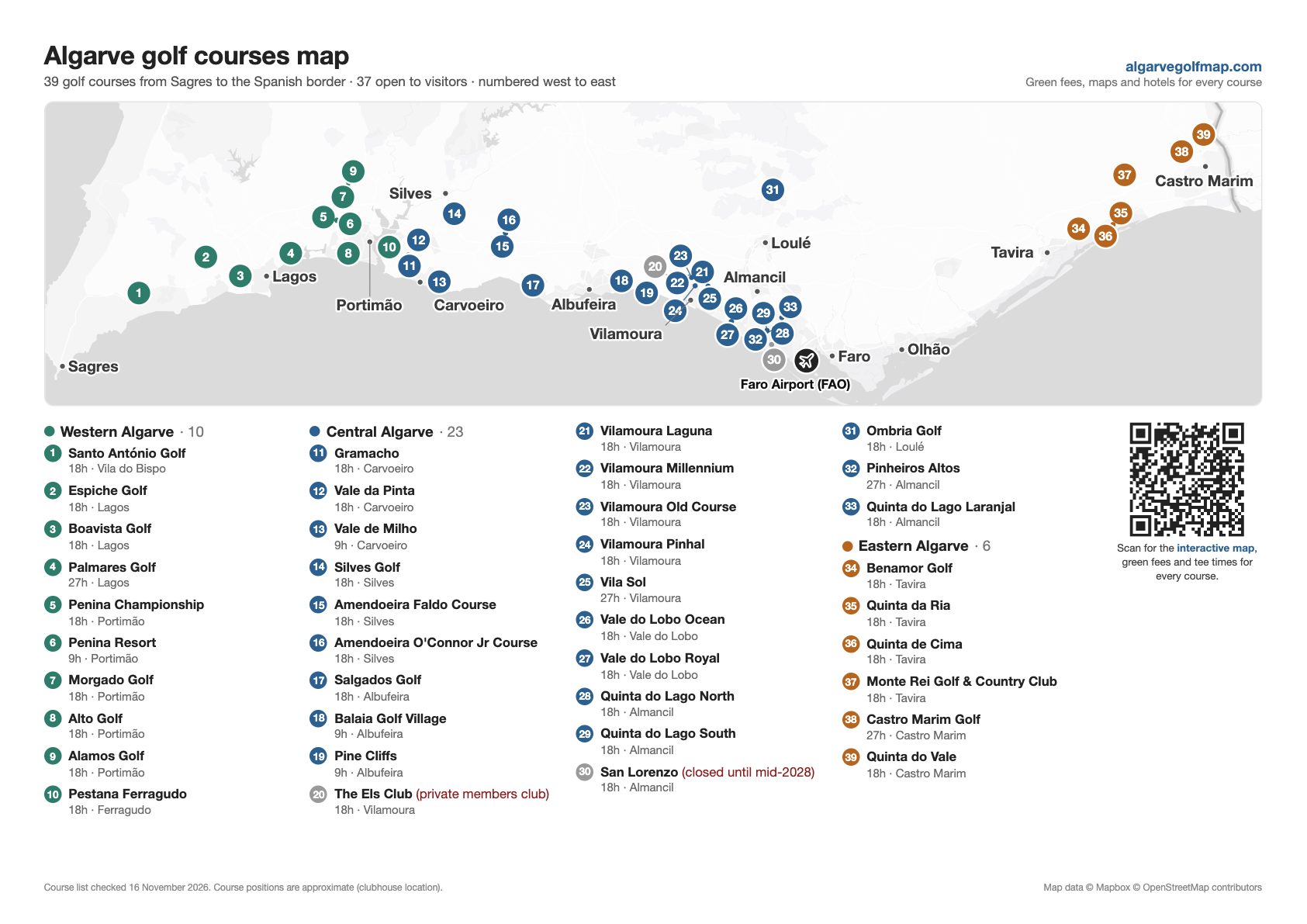
A free, printable map of every golf course in the Algarve on one A4 page. All 39 courses are numbered from west to east, from Santo António near Sagres to Quinta do Vale on the Spanish border, with Faro Airport and the main towns marked so you can see where to stay.
Download the PDF (free)PDF · A4 landscape · 0.4 MB · updated 16 November 2026
What is on the map
- All 39 golf courses, colour-coded by area: western, central and eastern Algarve.
- A key with each course's name, number of holes and nearest town.
- Faro Airport and the main towns, from Sagres and Lagos to Tavira and Castro Marim.
- Which courses visitors can't play: San Lorenzo is closed for renovation until mid-2028 and The Els Club is a private members club.
- A QR code that opens the interactive map, with green fees and tee times for every course.
Need more than a printed map?
The interactive Algarve golf map shows every course with drive times from Faro Airport, nearby hotels and green fees. For a side-by-side table with par and prices, see the full list of Algarve golf courses.
Download the PDF (free)Course positions are approximate (clubhouse location). Map data © Mapbox © OpenStreetMap contributors. You are welcome to print and share the map for personal use.